The Albertine graben covers a total land area of 6,788,616 ha. Out of this, 5,369,164 ha (79.1%) is under agriculture, settlement and other miscellaneous land uses. The remaining 1,419,452 ha (20%) are under protected areas form of land use. Protected areas include forest reserves (Central Forest Reserves, Jointly Managed Forests by UWA and NFA and Local Forest Reserves) and wild life conservation areas (national parks and wild life reserves). Forest Reserves cover a total area of 462,129 ha (7.01%) while wildlife conservation areas cover a total of 957,194 ha (14.5%).
The area, therefore, has four main types of land use namely; agriculture, settlements, forest conservation and wild life conservation with the protected areas occupying a significant proportion of the total land area, i.e. 20.9%, which has important implications on available land for agriculture and other activities.
Furthermore, the location of 10 out of the total 22 national parks and wildlife reserves in Uganda within the oil rich Albertine graben, presents a land use challenge. Oil development could disrupt conservation efforts if not well planned. Yet, another issue is that these National Parks and Forest Reserves, together with other protected areas inside and outside the Graben, form a relatively continuous protected areas system and are generally linked by wildlife corridors. These corridors facilitate the movement of wildlife between habitats that are increasingly being fragmented by farmed and urban ecosystems. The corridors movement promote exchange of genes, allow animal interactions and act as dispersal routes. The animal corridors also link Uganda’s protected area system to the larger protected areas in the Democratic Republic of Congo (DRC).
The major land tenure systems in the graben include customary, freehold, leasehold and public land. All protected forests and wild life conservation areas are under public land form of tenure, in addition to areas accommodating government institutions and infrastructure.
On private land, customary land tenure (both individual and communal) is the most widely practiced system. The majority of households in the areas around Karuma and Bugungu Wildlife Reserves in Masindi District, for instance, acquire land through inheritance, while a few purchase their land. For example, in Buliisa, land tenure remains largely customary, and all members of village communities communally own the land. The lack of a uniform land tenure system, however, presents management challenges particularly with regard to land speculation that has been exacerbated by the discovery of oil in the region. This is threatening to cause land use conflicts and landless households and communities in the area, as land purchases and delineation from the previously communally owned land continue to take place. This challenge is further exacerbated by the lack of a comprehensive land use plan.

Map 8: Albertine graben Land cover
Protected areas
Uganda has 39 wildlife protected areas including national parks, wildlife reserves, community wildlife areas and sanctuaries. Twenty two (22) out of the total of 39 protected areas are national parks and wildlife reserves, and 10 out of these are found in the Albertine region. The National Parks include Murchison Falls, Queen Elizabeth, the Rwenzori Mountains, Kibale, Semliki, Bwindi and Mgahinga. The Wildlife Reserves include Ajai and East Madi located in the extreme north-east of the Albertine graben; Bugungu and Karuma Wildlife Reserves in Buliisa and Masindi Districts; Tooro-Semliki, Kabwoya and Kyambura Wildlife Reserves in Bundibugyo, Hoima and Bushenyi respectively, and Kigezi Wildlife Reserve in the extreme south in Rukungiri and Kanungu Districts. The area also has a number of important Forest Reserves including Bugoma and Budongo Forest Reserves.
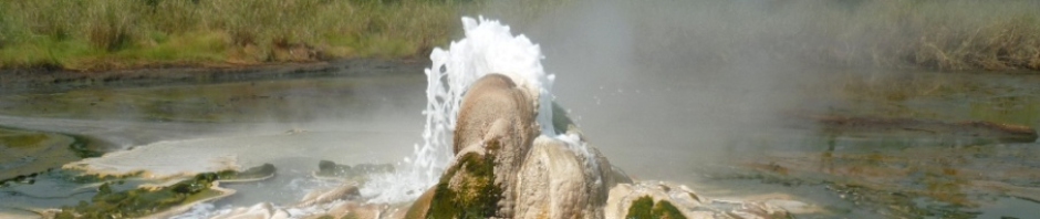
The Albertine Rift is an important region for global conservation. It harbors more species of vertebrates than any other region on the African continent. This region also shelters more than half of Africa’s bird species and nearly forty percent of its mammal species. There are more endemic mammals, birds and amphibians in the Rift Valley than any other site in continental Africa. In terms of biological diversity, the forests and lakes within this area constitute one of the richest parts of the world. The Rwenzori Mountains are reported to have more mammal species than any other site in Africa. The Albertine graben therefore serves as a significant wildlife conservation area, and home to a diversity of wildlife species. The area therefore has a high tourism potential, besides being vitally important for the conservation of the wildlife and their habitats.

Map 9: Albertine graben Protected Areas
Agriculture
The Albertine graben area comprises of different physical landscapes, climatic conditions and soils which in turn, significantly influence land use systems in the area including agriculture. Because of its location in the rain shadow, the Rift Valley zone is mostly dry and hot and hence the area has serious moisture deficiency problems for agricultural activities especially during critical crop growth periods. Furthermore, except for clay soils in the river Semliki flats, soils on the Rift Valley floor are dominantly sandy with excessive drainage characteristics, making the moisture deficiency problem arising from low rainfall even worse. In addition, the clay soils in the Semliki flats suffer from saline conditions which limits their agricultural potential. The largest proportion of the Rift Valley area therefore is, of low agricultural potential. This partly explains the current major use of the Albertine graben as a conservation area. However, the rift escarpment region and the foothills of Rwenzori Mountains receive moderate to high rainfall, largely due to orographic factors, which increases with altitude. As a result of both moderate to high rainfall and moderately productive soils in these areas, rich agricultural activities take place based on both food and cash crops, for example, on the escarpment part of Masindi, Tooro and Ankole regions as on the foothills of the Rwenzoris in Kasese District. Agriculture in the area is both large scale and small scale. The dominant cash crops grown on small scale farms include tobacco and cotton especially in Buliisa and Kasese, respectively. There is also coffee growing on both the foothills of the Rwenzori mountains and on a wide stretch of the rift escarpment particularly in the Ankole and Kigezi region. Tea plantations are found in Bugaambe sub-county in Hoima, Mwenge tea estates in the Tooro region, Igara tea estates in the Ankole region and in Kayonza tea estates in Kanungu district. There is only one sugar cane plantation, Kinyara, in Masindi District. The dominant food crops include beans, maize and bananas although these crops are also often sold for cash income.
In Kasese District, utilization of water from river Mubuku supports irrigation agriculture in the Mubuku irrigation scheme. Shallow sandy soils dominate on the rift escarpment slopes to the east and the mountain slopes to the west. The shallow sandy soils factor, coupled with the dominantly steep slopes landscape, high rainfall and peasant crop agriculture dominated by annual crops, makes the area very prone to soil erosion and mass wasting (landslides, soil slips and rock falls). Therefore, these areas are of marginal agricultural productivity and high sensitivity to degradation. Consequently, soil erosion and rapid decline in land productivity is a major environmental problem in this area, while soil erosion from these high land areas is the major cause of sedimentation of the rivers and lakes in the Rift Valley.
Livestock is another important agricultural activity, especially by the Batuku tribe on the Semliki flats in Ntoroko County and the Basongora in Busongora County. Therefore grazing lands for livestock are an important form of land use in the region especially the grasslands on the Rift Valley floor.

Map 10: Albertine graben Major Crops