My testpage

This is a test text. Nice weather outside with birds singing. This is a test text. Nice weather outside with birds singing. This is a test text. Nice weather outside with birds singing. This is a test text. Nice weather outside with birds singing.

This is a test text. Nice weather outside with birds singing. This is a test text. Nice weather outside with birds singing.

This is a test text. Nice weather outside with birds singing. This is a test text. Nice weather outside with birds singing. This is a test text. Nice weather outside with birds singing. 

Posted in Uncategorized | Leave a comment

My map

Posted in Uncategorized | Leave a comment

UGANDA Atlas of Our Changing Environment

Foreword

Uganda is a landlocked country in Eastern Africa. Our country is rich in natural resources and in the recent years we have been blessed with the discovery of oil in
the Albertine Graben. It is now common knowledge that development of any society should not be at the cost of future generations. Many people especially in rural areas,
are dependent on natural resources for their livelihood, and hence mainstreaming the sustainable use of these resources into Government plans and programs at all levels has been a priority of the NRM Government since it came to power in 1986. This Atlas seeks to highlight changes that have arisen from the effects of local activities and global phenomena. It also demonstrates the capacity Uganda has built over the last twelve years in using new technologies to provide information to aid decision making processes. Tracking environmental changes is not new because warnings have been
issued bi-ennially in the National State of Environment Reports (NSOER) since 1994.
However, the uniqueness of this publication is the evidence based information from
multi-temporal satellite images, ground photographs and graphics to confirm some of
the negative and positive changes in our environment.
This Atlas presents some positive changes in some areas which decision makers and
other readers will find useful. However, allow me to highlight some key findings which
need to be integrated in development plans in order to reverse the negative effects.
The siltation of our lakes due to uncontrolled activities on land especially for Lakes
Albert and Victoria needs urgent attention. The shrinkage in area of some lakes
especially for Wamala affecting the fish catch requires urgent intervention measures.
Loss of woody biomass due to charcoal burning and enchroachment of forested
ecosystems especially in Nakasongola, Nakaseke and Kiboga Districts will have big
consequences on the water regime and needs urgent intervention at both national and
local government levels. Finally unplanned settlements in drainage channels especially
in urban areas resulting in floods should be halted immediately.
I hope that this Atlas will make all the people of Uganda believe in the wealth of
our natural resources and also threats that we face as a country because of human
activities. There is a saying that “seeing is believing” and this Atlas provides visual
information of our changing environment.
I wish you all good reading.
Hon. Maria Mutagamba
MINISTER OF WATER AND ENVIRONMENT
THE REPUBLIC OF UGANDA
iv

Posted in Uncategorized | Leave a comment

Queen Foreword

Foreword

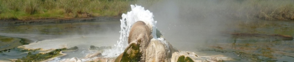
Queen Elizabeth National Park, Kyambura Wildlife Reserve and Kigezi Wildlife Reserve form the Queen Elizabeth Protected Area (QEPA) and lie within the Albertine Graben, which is a species-rich region in Uganda. QEPA provides a number of benefits to the people both within and outside the country. Tourism in the Protected Area (PA) has been improving over the last 10 years with over 35,000 visitors visiting the park every year. Like any other PA in Uganda, the park faces development challenges including inter alia, petroleum, mining, hydropower plants, roads, and electricity transmission lines. These developments have the potential to result in negative impacts that could compromise the ecological integrity of the PA. Petroleum exploration activities currently taking place in the Albertine Graben have also been carried out in the PA (Ngaji Exploration Block). With the country now moving towards production, the PA may face even more challenges.

This Environmental Sensitivity Atlas has been prepared to provide environmental planners with a tool to identify the most at-risk sensitive areas, establish protection priorities, and identify timely and appropriate response and cleanup strategies. The atlas provides information on various animal species, specifying their distribution, breeding information, and critical habitats. It also analyses sensitivities considering the physical, biological and socio-economic issues, and provides a map layer showing sensitive areas. This information will guide developers, licensees, managers and regulators on infrastructure and other facility locations during the implementation of various projects.

This tool has been prepared through a consultative process involving a number of stakeholders, and as such, it incorporates different aspects, i.e. biological, physical and socio-economic environments. Identifying with a wide range of sectors makes this tool particularly useful.

It is my sincere hope that this atlas will be put to use by all stakeholders to ensure that the various developments are implemented without negatively impacting the integrity of the PA. I am sure that when properly used, it will contribute to the protection of the PA.

I therefore entrust the Conservation Area Manager of QECA with this atlas, but also urge its use by all stakeholders to ensure that this atlas is used effectively during all decision-making relating to developments in and around the PA.


Dr. Andrew G. Seguya

EXECUTIVE DIRECTOR

UGANDA WILDLIFE AUTHORITY

Posted in Uncategorized | Leave a comment

sunset

felling wood in mbale

Posted in Uncategorized | Leave a comment

Good behavior

Posted in Uncategorized | Leave a comment

landuse

Landuse map

This is very important. Planning will get us somewhere. But not almost anywhere. It will get us to the future. This is important. Planning will get us somewhere. But not anywhere. It will get us to the future. This is important. Planning will get us somewhere. But not anywhere. It will get us to the future. This is important. Planning will get us somewhere. But not anywhere. It will get us to the future.

This is important. Planning will get us somewhere. But not anywhere. It will get us to the future. This is important. Planning will get us somewhere. But not any

Oreochromis leucostictus from Lake Nyaguo in Paliisa district, Eastern Uganda.

where. It will get us to the future. This is important. Planning will get us somewhere. But not anywhere. It will get us to the future. This is important. Planning will get us somewhere. But not anywhere. It will get us to the future.

This is important. Planning will get us somewhere. But not anywhere. It will get us to the future. This is important. Planning will get us somewhere. But not anywhere. It will get us to the future. This is important. Planning will get us somewhere. But not anywhere. It will get us to the future.

Posted in Uncategorized | Tagged , | Leave a comment

lands

landuse

Posted in Uncategorized | Leave a comment

Roan Antelopes still exit in Pian-Upe Wildlife Reserve

Posted in Uncategorized | Leave a comment

WordPress

This is the day for learning WordPress

Posted in Uncategorized | Leave a comment