Population Distribution

Map 11: Albertine graben Population Density
In the northern part of the graben, the districts of Arua and Nebbi have the highest population densities while Amuru has the lowest. In the central region, the districts with the highest population densities are Kibaale and Masindi while Buliisa and Kiboga have the lowest. Further south, the district with the highest population density is Bushenyi while Kasese and Rukungiri have the lowest.
Population Structure
The population structure in the Albertine graben reflects similar trends as those in the rest of the country. The population has a pyramid structure reflecting a large dependent age. More than 50 percent of the population lie between 0-20 years of age. There are also slightly more females than males representing 51 percent and 49 percent of the population, respectively.
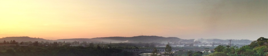
Urban Areas
The Albertine graben is a center of rapid urban growth (see map 12). There are several upcoming urban centers in the Albertine graben including Buliisa, Kasese, Masindi, Kanungu, Rukungiri, Hoima, Kagadi and Ntoroko. There is further growth of the old towns, with a large number of new town councils, town boards and municipalities coming up in the area. Oil exploration and development activities will most likely create further urbanization premises. This prospective growth needs proper planning to forestall unplanned urban sprawl, slum conditions and environmental degradation.

Map 12: Albertine graben Trading Centers and Major Towns
Fish Landing Sites
Fish landing sites are pockets of human settlements located along lake shorelines of the major lakes in the region: Lake Albert, Lake Edward and Lake George. They areinhabited by people who are engaged in fish related activitiesincluding fishing, fish processing, boat building and repair. The people are also engaged in other auxiliary services like food vending, retail business, bar and hotel operations. Generally, fish landing sites in the Albertine graben lakes are under serviced in terms of socio-economic infrastructure. The majority of the communities in fish landing sites use lake water for domestic purposes and sanitation facilities are poor. An overlay with the oil prospect areas indicates that a number of fish landing sites are located within the oil exploration areas. Oil drilling and production activities will exacerbate the existing poor service delivery situation. For example, oil spills on the lake will contaminate the sole source of water to residents of fish landing sites. Similarly oil exploration and drilling activities will necessitate relocation of residents of fishing communities with attendant disruption of economic activities and livelihoods. For instance, a Vice Chairman of Kazinga fish landing site on Lake Edward once remarked that “I heard rumors that we would be relocated to another place called Ruyinja during Seismic and oil exploration times, which we were not happy with. Generally we do not want to be relocated to another place or if we are shifted it should be to another place where we can continue with our fishing activities”

Map 13: Albertine graben Fishing Sites
Hotels and Lodges
There are a number of hotels and lodges within the Albertine graben. These have to date not been physically affected by oil drilling activities. The impact of drilling on tourism may, however, affect the profitability of the hotel sub-sector in particular, and the tourism sector in general, in the future. Efforts to buffer the sector from the impacts of oil exploration and development activities therefore need to be put in place. The key hotel and lodge facilities in the area include Mweya safari, Albert Safari, Paraa safari, Jacana, Kyambura, Wilderness Camp, Bwindi Forest Camp, Kibaale National Park Lodge, Chobe Safari, Red Chilli, Nile Safaris and Semliki Safari Lodge. The hotels and lodges were, however, left out of the sensitivity ranking system.
Infrastructure
Different attributes have been compiled to represent the socio economic data within the Albertine graben. The Key attributes represented in the socio-economic layer include:
- Roads
- Oil reserves and prospects
- Mineral areas
- Major towns and villages
- Fishing villages
- Boat landing sites
- Water reservoirs
- Power utility facilities and stations
Roads
The roads have been sub classified into primary all weather and secondary murram roads. The primary roads transect between cities whereas the secondary roads are within the district boundaries. Total coverage of tarmac road infrastructure in the area is limited with only a few hundred kilometers of tarmac. A few more roads are planned for upgrading to bitumen standard in the next ten year road sector plan. These include Kigumba-Masindi-Hoima to Kyenjojo (now at detailed engineering design stage), Hoima-Kaiso-Tonya (detailed engineering design), and Hoima-Biso-Wanseko which is at very preliminary planning stages. In terms of sensitivity to oil spillage, roads only facilitate the process of oil drilling and transportation of heavy machinery but may not be substantially affected by any oil spills. Good road access, however, is important to facilitate quick rescue and response in case of oil spills and accidents. Layout pipes can however be sited within the road reserves of primary roads which are wide enough (30m width).
Railway lines
Railway lines have also been identified within the graben region and these include the western line also popularly known as the Kasese line and the light density Pakwach line. Today the railway sector is largely non-functional. More than 30 percent of the tracks on the Kasese line have been removed and the line vandalized. The Tororo to Pakwach section has also been equally vandalized. Feasibility studies to rehabilitate the lines have, however, been initiated by the Ministry of Works and Transport. The functioning section of the railway system is currently limited to the transportation of goods such as imports from abroad and exports via Mombasa. This and the rehabilitated sections of the railway line could be utilized by the drilling and oil processing companies in future. The railway lines, however, have not been ranked in terms of sensitivity ranking
Airfields
There are four air fields located within the graben region that can facilitate the movement of goods and personnel. They include Kasese, Arua, Adjumani and Moyo. The air fields are of substantial economic and security importance within the region. They are however also very vulnerable to oil spillage except that drilling activities have to be controlled within their precincts for the threats that such activities may pose to the air fields.
Water Transport
There are four major water bodies within the Albertine graben that support water transport. They include Lakes Albert, George and Edward and River Nile. There are, however, only two scheduled ferry services on Lake Albert and River Nile at Wenseko to Panyimur and Paraa respectively. Several private motorised boats operate on the lakes, but have limited cargo capacity. This sector has a large potential to improve movement of goods and services in the graben. Considerable investment, however, will have to be made to improve safety, efficiency and effectiveness of water transport in the Albertine graben.
Tourism
There are 22 wildlife protected areas (national parks and wildlife reserves) in Uganda. Wildlife protected areas are managed by the Uganda Wildlife Authority (UWA). Some wildlife areas, particularly the forest based ones, are managed by the National Forestry Authority (NFA). Uganda’s tourism is nature based with up to 80 percent tourists coming to look at wildlife and scenery. Most of the protected areas in Uganda are located in the Albertine Rift and specifically in the area around Lake Albert. The most popular destinations are the Queen Elizabeth National Park (QENP) and Murchison Falls National Park (MFNP) with 65 – 70 percent of the country’s 82,000 to 130,000 visitors who went to the national parks between 2003 and 2006 going to these two parks.

Map 14: Albertine graben Revenue
Agriculture
The Albertine graben area comprises of different physical landscapes, climatic conditions and soils which, in turn, have significantly influenced land use systems in the area especially agriculture. Because of its location in the rain shadow, the rift valley zone is mostly dry and hot and; and except for clay soils in the river Semliki flats, soils on the rift valley floor are dominantly sandy, making the area to suffer from moisture deficiency. Moisture deficiency makes the area unsuitable for agriculture. The clay soils in the Semliki flats suffer from saline conditions which limits their agricultural potential. Therefore, the largest proportion of the rift valley area is of low agricultural potential, which partly explains its current major use as a conservation area.
However, to the south-west in Kasese District, moderately productive soils occur in areas flanking the foothills of the Rwenzori mountains and, with moderate rainfall received, this area supports significant agricultural activities based on maize, cotton and beans. In the same area, utilization of water from river Mubuku supports irrigation agriculture in the Mubuku irrigation scheme. Shallow sandy soils dominate on the rift escarpment slopes to the east and the mountain slopes to the west. These areas receive moderate to high rainfall, largely due to the orographic effect, increasing with altitude on the Rwenzori mountain slopes to the west. Agriculture in these areas is dominated by peasant small holders, based on crops like bananas, cassava, maize, legumes and coffee, the latter grown as a cash crop. The shallow sandy soils factor, coupled with the dominantly steep slopes landscape and peasant crop agriculture dominated by annual crops, makes the area very prone to soil erosion and mass wasting (landslides, soil slips and rockfalls). Therefore, these areas are of marginal agricultural productivity and high sensitivity to degradation. Consequently, soil erosion and rapid decline in land productivity is a major environmental problem in this area, while soil erosion from these high land areas is the major cause of sedimentation of the rivers and lakes in the rift valley.
Livestock is another important agricultural activity, especially practised by the Batuku tribe on the Semliki flats in Ntoroko county in Bundibugyo District and the Basongora in Busongora County in Kasese District. The Batuku are psychologically attached to their cows. Rwebisengo market in Ntokoro is one of the largest cattle markets in the country from where the sales are exported to urban areas in the country for supply of meat. Because of the cash earnings from livestock sales, the Batuku families have higher incomes compared to their neighbours on the escarpment and mountain slopes with a crop-based economy. Grazing land is communal and, this coupled with increasing population of both human and livestock, land availability is becoming limited, which has led to overgrazing. Thus, the Basongora communities rely heavily on their livestock for their livelihoods, both as a source food and for sale for cash income.
The development of oil production activities is likely to have a significant effect on the agricultural economy. On one hand, it may lead to increased demand for crop and livestock products, which may trigger increased competition for land use and subsequently, to pressure on the land resources; while on the other hand, emerging economic activities arising from oil production may lead to a transformation in the socio-economic activities of the local communities, that, in turn, will have implications on the environment and natural resources in the area.
Map 15: Albertine graben Major Crops
Fisheries
Fisheries activities provide an important source of livelihoods for the people in the Albertine graben. The region contributes 18.7% of the total national fish catch, which is quite significant and of this, 15% is contributed by Lake Albert alone. Fish processing has become an important activity on the lake, both at artisanal and industrial levels. At Butiaba landing site, there is a wild catch fish processing factory processing between 40 to 50 tons of Nile Perch per day and employing a labour force of 150 people. The most important sources of fish in the region are Lake Albert, Lake Edward, Lake George and rivers especially the Albert Nile, Waki, Wambabya, Semliki and Kazinga Channel. Lake Albert is the richest of the lakes in the region, in terms of the fish biodiversity, having about 53 fish species and about ten of which are endemic, for example, Alestes baremose (angara), Hydrocynus forsnkkahlii (ngasia) and Lates macropthalmus. Of the endemic species of Lake Albert, Lates macropthalmus is threatened. In general most the commercial fish species are under threat of heavy fishing pressure which could lead to over-exploitation. Studies conducted in the Albert area have shown that the Angara lagoon in the delta and lower floodplain zone of the Hohwa River Valley supports many species of fish, indicating possible use of the river by upriver migrant or andromous fish (fish that spawn upriver). The shallow inshore habitats of Lake Albert support the biology and ecology of virtually all fish species during their larval and juvenile life, and hence the sprawling fish landing sites owe their existence to the productive multi-species which, in turn, form the backbone of the socio-economic livelihoods of virtually all the lakeside communities and beyond. Thus, invertebrate fauna especially the macro-invertebrates as well as the young of most fish species spend their early life in this shallow inshore zone. Therefore, critical fish habitats especially shallow inshores and river mouths will likely be impacted upon by oil development activities. The key impacts may include severe siltation, bio-accumulation of CFCs in fish tissues, change in water quality resulting from sewage and other oil related development activities. Information available on distribution of aquatic macro-invertebrates show preferential distribution of aquatic invertebrates in the shallow inshore waters less than 7 m deep as compared to deeper off-shore waters. This has significant implications on the sensitivity of aquatic life to oil spills and possibly other pollutants. Recent field surveys recorded 27 fish species, which accounts for about 60 percent of the fish species expected to occur in the zone. This is an indication that the zone is still prime habitat. Small scale fishing also occurs at community level in the numerous streams and wetlands in the area. Unfortunately very little scientific information has been documented on the ecology and dynamics of the fisheries of these key habitats. The currently worrying status of fisheries resources in the region would be greatly exacerbated by oil spills or pollution resulting from oil development activities.

Kabwoya Game Reserve 2007 (Source: Uganda Wildlife Authority (UWA))